|
Hermes@Neo4j
|
|
Hermes@Neo4j
|
Protected Member Functions | |
| DefaultLayerTemporal () | |
| GraphDatabaseService | getDatabase () |
Static Protected Member Functions | |
| static LayerST | makeLayerFromNode (SpatialTemporalDatabaseService spatialDatabase, Node layerNode) |
| static LayerST | makeLayerAndNode (SpatialTemporalDatabaseService spatialDatabase, String name, Class< ?extends TemporalGeometryEncoder > geometryEncoderClass, Class< ?extends LayerST > layerClass) |
Protected Attributes | |
| Node | layerNode |
| TemporalGeometryEncoder | geometryEncoder |
| TemporalGeometryFactory | geometryFactory |
| LayerRTreeIndexTemporal | index |
Additional Inherited Members | |
 Public Attributes inherited from Neo4jSpatiotemporal.TemporalConstants Public Attributes inherited from Neo4jSpatiotemporal.TemporalConstants | |
| String | PROP_LAYER = "layer" |
| String | PROP_LAYERNODEEXTRAPROPS = "layerprops" |
| String | PROP_CRS = "layercrs" |
| String | PROP_CREATIONTIME = "ctime" |
| String | PROP_GEOMENCODER = "geomencoder" |
| String | PROP_GEOMENCODER_CONFIG = "geomencoder_config" |
| String | PROP_LAYER_CLASS = "layer_class" |
| String | PROP_TYPE = "gtype" |
| String | PROP_QUERY = "query" |
| String | PROP_WKB = "wkb" |
| String | PROP_WKT = "wkt" |
| String[] | RESERVED_PROPS |
| int | GTYPE_GEOMETRY = 0 |
| int | GTYPE_POINT = 1 |
| int | GTYPE_LINESTRING = 2 |
| int | GTYPE_POLYGON = 3 |
| int | GTYPE_MULTIPOINT = 4 |
| int | GTYPE_MULTILINESTRING = 5 |
| int | GTYPE_MULTIPOLYGON = 6 |
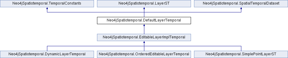
Instances of Layer provide the ability for developers to add/remove and edit geometries associated with a single dataset (or layer). This includes support for several storage mechanisms, like in-node (geometries in properties) and sub-graph (geometries describe by the graph). A Layer can be associated with a dataset. In cases where the dataset contains only one layer, the layer itself is the dataset.
You should not construct the DefaultLayer directly, but use the included factor methods for creating layers based on configurations. This will instantiate the appropriate class correctly. See the methods makeLayerFromNode and makeLayerInstance.
|
protected |
The constructor is protected because we should not construct this class directly, but use the factory methods to create Layers based on configurations
| SpatialTemporalDatabaseRecord Neo4jSpatiotemporal.DefaultLayerTemporal.add | ( | Node | geomNode | ) |
Add the geometry encoded in the given Node. This causes the geometry to appear in the index.
Implements Neo4jSpatiotemporal.LayerST.
| boolean Neo4jSpatiotemporal.DefaultLayerTemporal.containsGeometryNode | ( | Node | node | ) |
Does the dataset (or layer) contain the geometry specified by this node.
Implements Neo4jSpatiotemporal.SpatialTemporalDataset.
| void Neo4jSpatiotemporal.DefaultLayerTemporal.delete | ( | Listener | monitor | ) |
Delete Layer
Implements Neo4jSpatiotemporal.LayerST.
| Iterable<? extends Geometry> Neo4jSpatiotemporal.DefaultLayerTemporal.getAllGeometries | ( | ) |
Provides a method for iterating over all geometries in this dataset. This is similar to the getAllGeometryNodes() method but internally converts the Node to a Geometry.
Implements Neo4jSpatiotemporal.SpatialTemporalDataset.
| Iterable<Node> Neo4jSpatiotemporal.DefaultLayerTemporal.getAllGeometryNodes | ( | ) |
Provides a method for iterating over all nodes that represent geometries in this dataset. This is similar to the getAllNodes() methods from GraphDatabaseService but will only return nodes that this dataset considers its own, and can be passed to the GeometryEncoder to generate a Geometry. There is no restricting on a node belonging to multiple datasets, or multiple layers within the same dataset.
Implements Neo4jSpatiotemporal.SpatialTemporalDataset.
| CoordinateReferenceSystem Neo4jSpatiotemporal.DefaultLayerTemporal.getCoordinateReferenceSystem | ( | ) |
Each layer can represent data stored in a specific coordinate reference system, or projection.
Implements Neo4jSpatiotemporal.LayerST.
|
protected |
| SpatialTemporalDataset Neo4jSpatiotemporal.DefaultLayerTemporal.getDataset | ( | ) |
Each layer is associated with a SpatialTemporalDataset. This can be a one-for-one match to the layer, or can be expressed as many layers on a single dataset.
Implements Neo4jSpatiotemporal.LayerST.
| String [] Neo4jSpatiotemporal.DefaultLayerTemporal.getExtraPropertyNames | ( | ) |
Each layer contains geometries with optional attributes.
Implements Neo4jSpatiotemporal.LayerST.
| TemporalGeometryEncoder Neo4jSpatiotemporal.DefaultLayerTemporal.getGeometryEncoder | ( | ) |
Return the geometry encoder used by this SpatialDataset to convert individual geometries to and from the database structure.
Implements Neo4jSpatiotemporal.LayerST.
| TemporalGeometryFactory Neo4jSpatiotemporal.DefaultLayerTemporal.getGeometryFactory | ( | ) |
Implements Neo4jSpatiotemporal.LayerST.
| Integer Neo4jSpatiotemporal.DefaultLayerTemporal.getGeometryType | ( | ) |
The layer conforms with the Geotools pattern of only allowing a single geometry per layer.
Implements Neo4jSpatiotemporal.LayerST.
| LayerIndexReaderTemporal Neo4jSpatiotemporal.DefaultLayerTemporal.getIndex | ( | ) |
Every layer using a specific implementation of the SpatialTemporalIndexReader and SpatialTemporalIndexWriter for indexing the data in that layer.
Implements Neo4jSpatiotemporal.LayerST.
| Node Neo4jSpatiotemporal.DefaultLayerTemporal.getLayerNode | ( | ) |
All layers are associated with a single node in the database. This node will have properties, relationships (sub-graph) or both to describe the contents of the layer
Implements Neo4jSpatiotemporal.LayerST.
| Iterable< ? extends LayerST> Neo4jSpatiotemporal.DefaultLayerTemporal.getLayers | ( | ) |
This dataset contains only one layer, itself.
Implements Neo4jSpatiotemporal.SpatialTemporalDataset.
| String Neo4jSpatiotemporal.DefaultLayerTemporal.getName | ( | ) |
Every layer is defined by a unique name. Uniqueness is not enforced, but lack of uniqueness will not guarrantee the right layer returned from a search.
Implements Neo4jSpatiotemporal.LayerST.
| PropertyMappingManagerTemporal Neo4jSpatiotemporal.DefaultLayerTemporal.getPropertyMappingManager | ( | ) |
Implements Neo4jSpatiotemporal.LayerST.
| SpatialTemporalDatabaseService Neo4jSpatiotemporal.DefaultLayerTemporal.getSpatialDatabase | ( | ) |
Since the layer is a key object passed around to most code, it is important to be able to access the generic spatial API from this object.
Implements Neo4jSpatiotemporal.LayerST.
| Object Neo4jSpatiotemporal.DefaultLayerTemporal.getStyle | ( | ) |
Override this method to provide a style if your layer wishes to control its own rendering in the GIS. If a Style is returned, it is used. If a File is returned, it is opened and assumed to contain SLD contents. If a String is returned, it is assumed to contain SLD contents.
Implements Neo4jSpatiotemporal.LayerST.
| void Neo4jSpatiotemporal.DefaultLayerTemporal.initialize | ( | SpatialTemporalDatabaseService | spatialDatabase, |
| String | name, | ||
| Node | layerNode | ||
| ) |
The layer is constructed from metadata in the layer node, which requires that the layer have a no-argument constructor. The real initialization of the layer is then performed by calling this method. The layer implementation can store the passed parameters for later use satisfying the prupose of the layer API (see other LayerST methods).
| spatialDatabase | |
| name | |
| layerNode |
Implements Neo4jSpatiotemporal.LayerST.
|
staticprotected |
Factory method to construct a layer with the specified layer class. This can be used when creating a layer for the first time. It will also construct the underlying Node in the graph.
| spatialDatabase | |
| name | |
| layerClass |
|
staticprotected |
Factory method to construct a layer from an existing layerNode. This will read the layer class from the layer node properties and construct the correct class from that.
| spatialDatabase | |
| layerNode |
| void Neo4jSpatiotemporal.DefaultLayerTemporal.mergeExtraPropertyNames | ( | String[] | names | ) |
| void Neo4jSpatiotemporal.DefaultLayerTemporal.setCoordinateReferenceSystem | ( | CoordinateReferenceSystem | crs | ) |
| void Neo4jSpatiotemporal.DefaultLayerTemporal.setExtraPropertyNames | ( | String[] | names | ) |
| void Neo4jSpatiotemporal.DefaultLayerTemporal.setGeometryType | ( | Integer | geometryType | ) |
|
protected |
|
protected |
|
protected |
|
protected |
 1.8.10
